The CZU Lightning Complex fire was an unprecedented fire event throughout all of recorded history for the Santa Cruz Mountains. Here we will report what happened, why it happened, and what it means. Although the fire burned many vegetation types, we will focus here on the redwood forest which comprised the bulk of the burn area. The burn area boundary is shown on the map found here.

Remains of Park Headquarters building, Big Basin State Park. © California State Parks, all rights reserved
Many local land conservancies and conservation groups that focus on redwoods have down-played the seriousness of this fire. They’ve told the public that redwoods need fire to reproduce or that redwood forests are well adapted to fire. Neither is true. Redwoods are adapted to fire, but their forest associates are not.
Prior to the arrival of Europeans, fires in the redwood forest were mainly low to moderate intensity ground fires that burned the litter layer, forest floor vegetation, shrubs, and small trees, but seldom entered the canopy of the dominant redwoods and Douglas-firs. Lightning was the primary source of ignition, but lightning was a rare event in the Santa Cruz Mountains. Fire frequency increased during the Aboriginal period (11,000 BP – 1792 AD) to a value between 17 and 82 years apart as fires set by indigenous people to promote and retain grasslands sometimes spread into the redwood forest. During the early Anglo-American period (1848 – 1929) the fire return interval was between 20 – 50 years as much of the forest was clearcut and fire was used as a tool to clear brush and debris and ease the extraction of downed trees. In recent times, at least up until the 2000s, fires in the redwood forest have been suppressed, and fire frequency lowered to about one fire every 130 years according to a study by Greenlee and Langenheim (1990). Fire suppression has likely led to an increase in highly flammable fuels which has been aggravated over the last 20 years by the deaths of many tan oak (Notholithocarpus densiflorus) trees in the understory layer due to arrival and persistence of the Sudden Oak Death pathogen.
Until the recent period, most fires would stay low and burn with much less severity than the CZU fire. Only rarely would they enter the redwood and Douglas-fir tree crowns. They would blacken the thick outer bark of the old-growth Douglas-firs but not kill the trees. They would scorch the large down logs on the forest floor but not devour them. They would burn up the litter layer but not be so hot as to completely sterilize the organic soil layer below. Most importantly, they served to reduce the fuel build-up on the forest floor and remove ladder-fuels that, if allowed to persist, could carry fire into the tree canopies. These fires would typically skip over areas thereby leaving behind a mosaic of burned and unburned patches. The unburned areas along with the unburned down logs would serve as refuges from the fire for small animals, invertebrates and mycorrhizal fungi. Consequently, these types of fires did not have serious long-term adverse impacts on the redwood forest biotic community.

Severely burned redwood stand, Big Basin State Park. Photo: Steve Singer
Redwoods themselves are resistant to death by fire, having the ability to send up sprouts from the root collar. Mature trees also have a thick bark layer that protects the cambium layer inside the trunk so that even a crown fire that burned all the branches off the trunk would not kill the tree. Dormant buds beneath the bark survive and send out new branches so that a new, (albeit thinner) live crown would form. On the other hand, old-growth Douglas-firs will likely succumb to the fire and their falling may knock down other trees including redwoods. A severely burned forest releases large amounts of stored carbon from its branches, understory vegetation, litter layer, and soil. Furthermore the growth in height of a tree and its ability to sequester new carbon as wood is temporarily impaired until it has recovered from the fire, typically requiring multiple years if not decades.
The CZU Lightning Complex Fire was not a typical redwood fire. It started in the early morning of August 16, 2020 when the remnants of Tropical Storm Elida swept across Central California and generated nearly 11,000 dry lightning strikes. This was a super-spreader lightning fire event without precedent in recent history. As UCLA climate scientist Daniel Swain blogged, “I’m essentially at a loss for words to describe the scope of the lightning-sparked fire outbreak that has rapidly evolved in Northern California…. It’s truly astonishing.”
Down tree across Sky Meadow Road, Big Basin State Park. © California State Parks, all rights reserved
A number of those strikes hit the Santa Cruz Mountains setting off about 22 small fires. Out of these 22 fires, five persisted and slowly spread through the forest. Three were located in difficult-to-access areas of the Butano Creek Watershed. On the night of August 18 a dry northeast wind began to blow strongly with gusts of up to 74 miles per hour. These new conditions caused the fires to explode, merge with each other, and spread with, as Dr. Swain noted, “astonishing speed”. Over the next two days they burned over 40,000 acres.
The rapid spread was accompanied with high intensity heat and burning away of the live crowns. It was during this period of rapid spread with high intensity burning that the old-growth forests of Big Basin Redwoods State Park burned. After the fire, experienced local fire boss Portia Halbert visited the park. Viewing the old-growth trees near park headquarters (now burned to the ground), she described the scene this way, “It looks like a bomb went off here.” Dr. Daniel Swain described the fire in Big Basin as “particularly intense.” Mark Hylkema, Supervisor of Cultural Resources for State Parks, visited Big Basin after the fire and said, “I’ve never had to deal with anything of this totality.”
On the night of August 20, the weather changed for the better. The winds died down and their direction gradually changed from easterly to westerly. Humidity went up as a layer of marine air began to penetrate the fire area. The growth of the fire then slowed dramatically and fire fighters were able to make good progress. The fire wasn’t fully contained until September 22, having burned 86,500 acres and destroying 925 homes in the wildland–urban interface. It was the biggest fire in the Santa Cruz Mountains Bioregion since at least 1940, the first year with accurate records of fire size.
Damage to several rural residential areas was extensive. In addition to burning down structures, much of the infrastructure that provided energy, water, communications, and waste removal was destroyed. Recovery will be a slow and expensive process. Our hearts go out to those who lost their homes and their belongings in this unprecedented event. Tragically, there was one fatality.

Old-growth redwood felled by fire, Big Basin State Park. Photo: Steve Singer
We also grieve for losses to the redwood forest community. The fire hit our remaining old-growth forests particularly hard. Over half of the remaining old-growth stands in the Bioregion were burned and most, such as those in Big Basin, were severely burned. The full extent of the damage has yet to be determined, but whatever the damage, salvage logging of redwoods should not be considered.
In addition to the redwoods themselves, the redwood forest community includes the understory and forest floor vegetation, wildlife (birds, mammals, amphibians, reptiles, invertebrates), insects and other invertebrates, microscopic soil fauna, and last, but not least, fungi — including the mycorrhizal fungal network that is essential for the health of redwood trees. The fire in Big Basin seems to have left few refuges for these species so most must have perished in the flames. As a consequence, there are few “seed source” areas for re-colonization of the burned stands and recovering the native biodiversity.
The marbled murrelet (Brachyramphus marmoratus), an endangered species of seabird that nests only in old-growth trees, was also impacted greatly by the fire. The timing of the fire, about one month before the normal end of the nesting season, means that some young and flightless murrelets likely were still in the nest when the fire hit. Since the total population of this bird is believed to be only 400 – 600 individuals, the loss of even a few birds to the fire is significant.
The fire also reduced the available murrelet nesting habitat for future seasons. As a crown fire, it burned away redwood tree branches including the large diameter branches high in the canopy that murrelets use for nesting. New branches will form in redwoods, but these fire-sprouted branches remain smaller than the original branches, and old-growth trees that survived the last major crown fire to burn a portion of the park, which was in 1904, still have not produced branches large enough to support a murrelet nest. Superposition of the CZU fire perimeter map on the map of murrelet nesting areas in the Santa Cruz Mountains shows that 62% of the known nesting acreage was burned by this fire, posing the question, will murrelets now find enough suitable nesting habitat?

Stump still burning two months after fire, Big Basin State Park. Photo: Steve Singer
The CZU fire was like two different fires wrapped up into one event. From the sixth day on it was a typical redwood fire spreading slowly and burning with low intensity within the forest. This was very fortunate for people who live in Boulder Creek, Ben Lomond, Felton, and Scotts Valley who had been evacuated from their homes because of the fire. It was a different fire during the two days between August 18 and 20 when it burned with a speed and intensity similar to that which destroyed the town of Paradise. For that period of time it was a true mega-fire.
Mega-fires are caused by global warming and are on the increase in California. A recent study from climate scientists at Stanford University has found that autumn days with extreme fire weather have more than doubled in California since the early 1980s due to climate change. As co-author Dr. Daniel Swain explained, “climate change has increased fire risk by increasing vegetation aridity — what’s known as fuel moisture — over time; meaning vegetation becomes more flammable. Increasingly, dry vegetation burns more intensely, creates more intense and larger fires, which spread more quickly and are harder to fight.” The senior author, Dr. Noah Diffenbaugh, warns that, “the same research that shows global warming has increased the frequency of extreme weather historically also suggests that continued global warming will intensify these conditions further.” Climate change wildfires may become the new normal.
While coast redwood trees are renowned for their resistance to fire and their seemingly indomitable resilience, the severity of this fire should not be discounted. The CZU Lightning Complex fire was very damaging to our old-growth redwood forests and their associated flora and fauna. Unlike its cousin, the giant sequoia (Sequoiadendron giganteum), coast redwood (Sequoia sempervirens) is not dependent on fire, and it is quite possible that this coast redwood forest will not rebound as fully as we hope.
The CZU Lightning Complex fire is a foreteller of things to come unless we as a society start to take global warming more seriously. Efforts to stop climate change must begin in every household, must be fully embraced by our nation, and must be pursued vigorously by every country in the world. Whatever efforts we have begun already need to be intensified now.
For more information about global climate change go here.
#####
UPDATE, Summer 2022: Bioregional Council director and murrelet expert Steve Singer with the help of avian biologist Alex Rinkert have been visiting the park to assess the survival rate of suitable murrelet nest platforms in surviving old-growth redwoods and Douglas-firs. They found that the number of suitable murrelet nest trees that survived the fire is only about 20% of the number present before the fire. These results are still preliminary, but suggest strongly that the murrelets will now have a difficult time finding nest sites in Big Basin other than in one of the two small green spots that did not burn. The 2021 murrelet nest found in the park by Alex was in one such location.

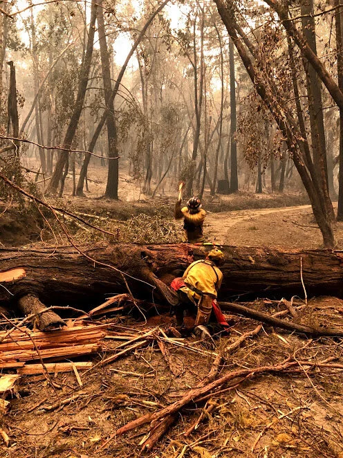
Park officials walk on ridgeline west of Elliot Creek, near Highway 1. © California State Parks, all rights reserved
SOURCES:
Fire History and Normal Fire Behavior
Agee, J.K. 1993. Fire Ecology of Pacific Northwest Forests. Island Press, Covelo, CA.
Evarts, J. and M. Popper. 2001. Coast Redwood – A Natural and Cultural History. Cachuma Press, Los Olivos, CA.
Greenlee, M.J. and J.H. Langenheim. 1990. Historic Fire Regimes and Their Relation to Vegetation Patterns in the Monterey Bay Area of California. American Midland Naturalist 124(2):239-253.
Jones, G.A. and W. Russell. 2015. Approximation of Fire-return Intervals with Point Samples on the Southern Range of Coast Redwood Forest, California. Fire Ecology 11(3):80-94.
Keeley, J.E. 2002. Native American Impacts on Fire Regimes of the California Coastal Ranges. Journal of Biogeography 29:303-320.
Moore, Z.E. and S.W. Singer. 2014. Discovery of the Tallest Redwoods in the Santa Cruz Mountains – Their Distribution and Ecology. Journal of Undergraduate Research and Scholarly Excellence 5:48-53.
Ramage, B.B., K.L. O’Hara, and B.T. Caldwell. 2010. Role of Fire in the Competitive Dynamics of Coastal Redwood Forests. Ecosphere 1(6):1-18.
San Lorenzo Valley Water District. 2009. Watershed Management Plan Part I – Existing Conditions Report. San Lorenzo Valley Water District, Boulder Creek, CA.
Sugihara, N.G., J.W. Van Wagtendonk, K.E. Shaffer, J. Fite-Kaufman, and A.E. Thode. 2006. Fire in California’s Ecosystems. University of California Press, Los Angeles, CA.
Tropical Storm Elida and Lightning Fire Starts
Roston, E. 2020. California’s Climate Tinderbox: A Scientist Explains the Fire Crisis. Bloomberg Green, August 25, 2020.
Swain, Daniel. 2020. Remarks recorded in LinII, R., L. Money, A.Wigglesworth, and J. Mozingo. 2020. Northern California Fires Rage on: We are Essentially Living in a Major Fire Era. L.A. Times, August 24, 2020.
Fire Spread and Burn Intensity
Brunton, Mark, Cal Fire Operations Section Chief, 2020a. Public remarks at August 20 Press Briefing on CZU Lightning Complex Fire. Scotts Valley, CA.
Brunton, Mark, Cal Fires Operations Section Chief. 2020b. Public remarks at September 22 Press Briefing on CZU Lightning Complex Fire, Scotts Valley, CA.
Cal Fire. 2020. CZU Lightning Complex Fire Progression Map CA-CZU-005205.
Halbert, Portia. Personal communication. September 11, 2020.
Hylkema, Mark. 2020. Remarks recorded in Friends of Santa Cruz State Parks, 2020. Through the Flames. Viewed online at www.thatsmypark.org on October 9, 2020.
San Mateo County/Santa Cruz County CWPP. 2017. Fire History Map. Viewed online at www.firesafesanmateo.org/resources/fire-history on October 9, 2020.
Swain, Daniel. 2020. Remarks recorded in Roston, E. 2020. (cited above)
Damage to Old-Growth Forest Community
Cal Fire. 2020. (cited above)
Halbert, Portia. 2020. (cited above)
Lazzeri-Aerts, R. and W. Russell. 2014. Survival and Recovery Following Wildfire in the Southern Range of the Coast Redwood Forests. Fire Ecology 10(1):43-55.
Impacts on the Marbled Murrelet
Baker, L.M., M.Z. Peery, E.E. Burkett, S.W. Singer, D.L. Suddjian, and S. R. Beissinger. 2006. Nesting Habitat Characteristics of the Marbled Murrelet in Central California Redwood Forests. Journal of Wildlife Management 70(4):939-946.
Halbert, P. and S.W. Singer. 2017. Marbled Murrelet Landscape Management Plan for Zone 6. Report prepared for California Department of Parks and Recreation, Santa Cruz District, Felton, CA. Available online at www.parks.ca.gov/MAMU.
Halbert, P. and S.W. Singer. 2017. Status of the Marbled Murrelet in the Santa Cruz Mountains. Unpublished white paper prepared for 2017 Murrelet Audio-visual Forest Surveyor Training Class, Gazos Mountain Camp, CA.
Singer, S.W. 2012. Personal observations in Big Basin Redwoods State Park, June through September.
Climate Change Wildfires – The New Normal
Diffenbaugh, N. 2020. Remarks recorded in Jordan, R., 2020, Stanford Researchers Discuss Wildfire Weather. Stanford Science Digest, August 27, 2020.
Goss, G., D.L. Swain, J.A. Abatzoglou, A.Sarhadi, C.Y. Kolden, A.P. Williams, and N.S. Diffenbaugh. 2020. Climate Change is Increasing the Likelihood of Extreme Autumn Wildfire Conditions Across Californica. Environmental Research Letters 15(9):1-14.
Swain, Daniel. 2020. (cited above)